Coyote Gulch
To Jacob Hamblin's Arch
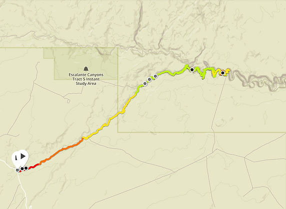
DISTANCE
33.5 km
out and back
TIME
8h20
ELEVATION
200m
Max 1425
Min 1209
ESSENTIALS
SEASON
(of the report)
YOU'LL NEED
-
Good shoes
-
Waterproof bags
-
Hiking poles
-
4L of water/person
It is important to note that this hike report is about the trail that goes out and back from hurricane wash. As most of you know I'm afraid of heights, thus choosing this itinerary was the best option for somebody like me. However, if you prefer to take the point-to-point trail option you'll have less mileage (18km) to cover but as a trade-off you'll have to climb (up or down, depending on where you start) a very steep part that is nearly 45 degrees incline.
BEFORE GOING:
-
As this is a day hike it doesn't require a backcountry permit, but I'll advise to sign the trail register and tell some friends that you are planing this hike. More information here.
-
Keep in mind this is a strenuous and long trail, you'll have to be attentive to the time and will not have so much time to take breaks and relax (again, if you're doing this in one day).
-
Bring: plenty of water (4L/person) and food, this is total wilderness, you need to be self-sufficient. On the same topic, take some warm clothes because it can feel really cold when the sun goes down. Better be safe than sorry!
-
Check the weather and ask rangers. If they advise you not to go...just don't!
WHEN TO GO?
This hike's is similar to the Narrows in Zion NP because you're walking in a river bed down a canyon! So, obviously the major risk is a flash flood. It is advised to go in summer or fall but even during those months you have to monitor the weather until the last moment. Keep in mind that even if you're not seeing a single cloud above your head, flash floods can still occur as a thunderstorm miles away can trigger them.
If you still have a question do not hesitate to contact me with the form below or to visit the park's website.
N.B. : We had a GPS watch but as we were down in a canyon it didn't manage the change of altitude so well by sometimes putting us on the top of the canyon. I don't have precisely the time we did for each portion of the trail so I'll try to approximate, hence the hike description will not be as precise as others.
START - HOLE IN THE ROCK ROAD
From Escalante- Hwy 12 you'll have to take the "Hole in the Rock" road during approximately 45km on to the trailhead. This is a dirt road which means that a 4WD is strongly suggested as well as informations on the road conditions that you can get at the rangers station ( because dirt + rain = mud).
The first part of the hike takes place in a dry wash with no elevation gain, thus I'll suggest to go pretty fast so that you'll have more time to enjoy the beautiful canyon. Orientation is key here, the trail isn't clearly marked all the time as the gulch can take different paths at some places. Also if you plan on doing it during summer months, it is important to note that there is literally no shade on this part. After approximately 2 hours (7.5km) you'll reach the river and enter Coyote Gulch, from this point on your feet are getting wet for the rest of the day!


INTO THE CANYON
It is pretty nice to wander between canyon walls, the landscape starts to be more scenic and surprising at every corner. As I said before and depending on the weather, your feet will be wet while crossing the river multiple times, although we saw some people just walking all the way in the river (be careful as sometimes it can be deeper than you think).
I have to say that I really enjoyed this hike and felt really alone compared to the Narrows which is a much more touristic place, we only met a mother and her 2 sons hiking back out.


JACOB HAMBLIN'S ARCH
To reach the Jacob Hamblin's arch it will take 5 more kilometers after you entered the canyon (12.5km from the start), which is equivalent to 1 hour. Once you're in the canyon it goes faster as it is - still - flat and you're not loosing time to find your path.
There's a camping place where you can enjoy the beautiful arch and take a well deserved rest before hiking back out. Reminder: when stopping, in any case it is good to be in an elevated area. Also you can wander a little bit further (5 minutes) and see the majestic arch from the other side as well as the trail I mentioned where you have to climb out of the canyon. This just confirmed that I couldn't do it.


Do not forget to check the time because the hike back will be long, as it always is when walking the same way back. However there is no elevation gain (nor loss) and it took us the same time (3 hours) to get back to the parking lot, I can tell you that the last hour was difficult on the motivation side. Hopefully we got lucky and met some really cute animals that made our journey much more pleasant.
One last general observation: don't be fooled by those beautiful landscapes, this is total wilderness with all the related hazards and surprises, be prepared and respect the environment you're walking in. Otherwise, just enjoy the beauties nature gave us!